
If you want more information on the area visit our local West Mayo Destination page or our regional Mayo Destination page.
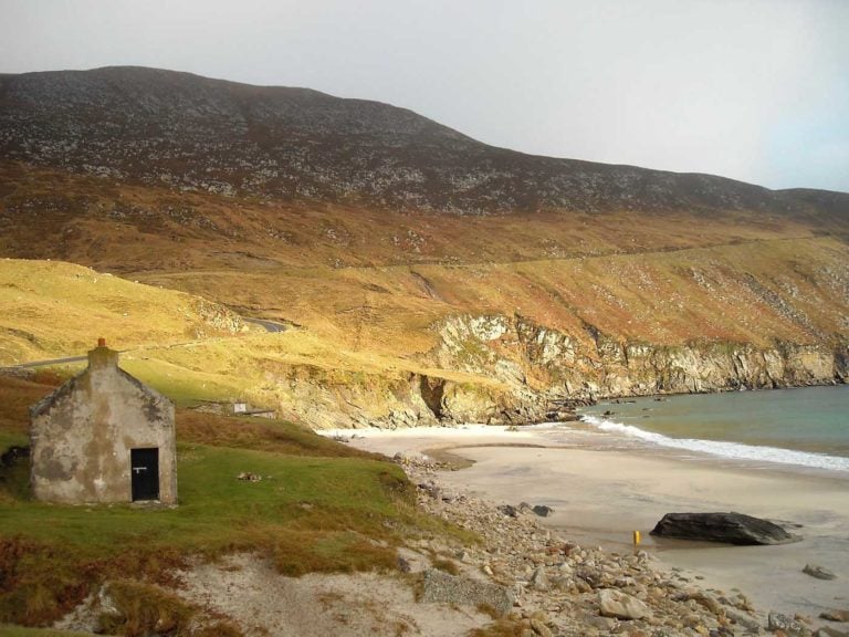
Getting to Dugort Beach
Dugort Beach 7 Day Weather Forecast
Today

Expect a temp in the range 10.6℃ to 11.3℃ with wind speed 5.6 m/sec (NNW)

Expect a temp in the range 10.6℃ to 11.3℃ with wind speed 5.6 m/sec (NNW)
Saturday, Apr 20
Expect a temp in the range 5.1℃ to 7.7℃ with wind speed 2 m/sec (ENE)
Expect a temp in the range 5.1℃ to 7.7℃ with wind speed 2 m/sec (ENE)
Sunday, Apr 21
Expect a temp in the range 8.3℃ to 8.8℃ with wind speed 2.1 m/sec (SE)

Expect a temp in the range 8.3℃ to 8.8℃ with wind speed 2.1 m/sec (SE)
Monday, Apr 22
Expect a temp in the range 8℃ to 9.3℃ with wind speed 3.4 m/sec (NE)

Expect a temp in the range 8℃ to 9.3℃ with wind speed 3.4 m/sec (NE)
Tuesday, Apr 23
Expect a temp in the range 9.3℃ to 9.5℃ with wind speed 5.3 m/sec (NNE)
Expect a temp in the range 9.3℃ to 9.5℃ with wind speed 5.3 m/sec (NNE)
Wednesday, Apr 24
Expect a temp in the range 9.4℃ to 9.8℃ with wind speed 5.6 m/sec (N)

Expect a temp in the range 9.4℃ to 9.8℃ with wind speed 5.6 m/sec (N)
Thursday, Apr 25
Expect a temp in the range 9.3℃ to 10℃ with wind speed 5 m/sec (WNW)

Expect a temp in the range 9.3℃ to 10℃ with wind speed 5 m/sec (WNW)
Our West Mayo weather forecast is from Yr, delivered by the Norwegian Meteorological Institute and NRK
Other Attractions...
While visiting Dugort Beach, take the opportunity to explore other attractions in the area.


At Coast Radar, we try and keep our details up to date, but unfortunately, we sometimes don't keep up. If you see a problem with this entry or think we have missed something, please use the report button below to let us know of the problem.