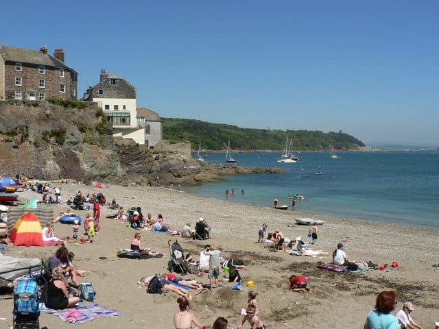
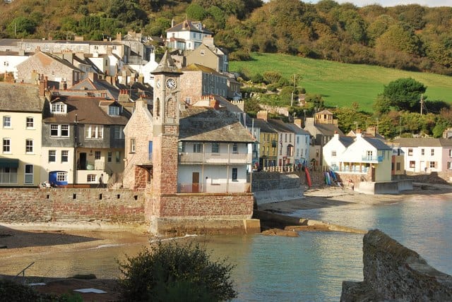
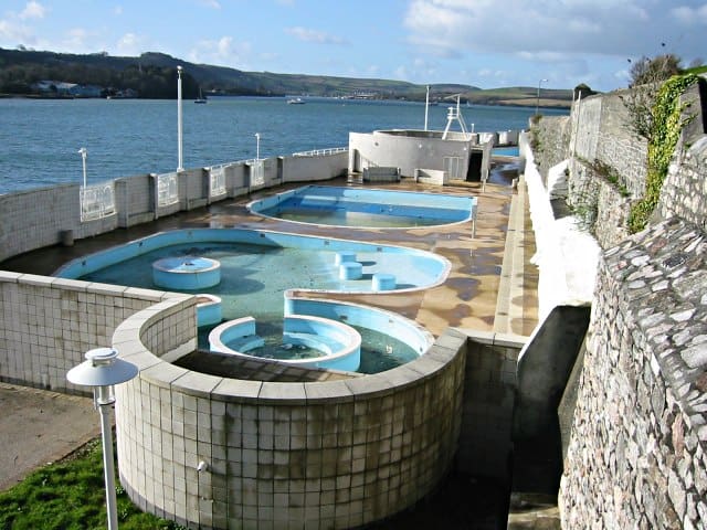
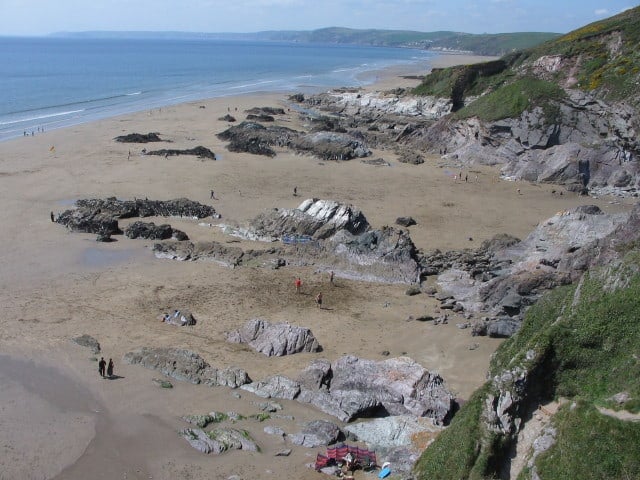
Cawsand and Kingsand are two small villages within Cawsand Bay.
They have sand and shingle beaches sheltered by Rame Head Peninsula offering views over Plymouth Sound. There are also rock pools to explore and slipways for easy access to the sea.
The villages have a history with much involvement in smuggling and fishing. Remains of old pilchard cellars from the late 16th century can be seen on the shoreline just beyond Kingsand. These ‘Pilchard Palaces’ were for the storing and processing of this most prized fish.
Facilities at the beach include slipways, toilets and shops.
Dog Friendly Beach?
We have no current information on dog restrictions for Cawsand Bay Beach.
Water samples are taken at regular intervals during the bathing season and at the end of the season the water quality is classified as: - Excellent: the highest classification meaning the water is cleanest - Good: generally good water quality - Sufficient: meets minimum standards - Poor: You are advised not to swim. The beach will stay open and an action plan should be in place to improve the water quality.
7 Day Weather Forecast
Today Expect a temp in the range 10.2℃ to 11.8℃ with wind speed 18.4 m/sec (W)
Saturday, Apr 01 Expect a temp in the range 9.6℃ to 9.9℃ with wind speed 12.3 m/sec (W)
Sunday, Apr 02 Expect a temp in the range 8℃ to 8.6℃ with wind speed 9.5 m/sec (NNW)
Monday, Apr 03 Expect a temp in the range 6.2℃ to 7.7℃ with wind speed 3.8 m/sec (NE)
Tuesday, Apr 04 Expect a temp in the range 7.6℃ to 8.7℃ with wind speed 3.8 m/sec (ESE)
Wednesday, Apr 05 Expect a temp in the range 10℃ to 10.2℃ with wind speed 3.5 m/sec (W)
Thursday, Apr 06 Expect a temp in the range 9.7℃ to 10.4℃ with wind speed 4.1 m/sec (WNW)
Rame Peninsula weather forecast from Yr, delivered by the Norwegian Meteorological Institute and NRK
Cawsand Bay Beach Tide Times
Tide times are available at around 600 locations and the closest location to Cawsand Bay Beach is at Whitsand Bay 3.47 km (2.16 miles) away. Tides are displayed beneath for up to 7 days and we list both high and low water times along with the height. These times are not adjusted for BST.
Fri 31 Mar Low Tide at 06:52 (Height 2.36m) High Tide at 13:47 (Height 4.03m) Low Tide at 19:28 (Height 2.38m)
Sat 01 Apr High Tide at 02:10 (Height 4.30m) Low Tide at 08:50 (Height 2.15m) High Tide at 14:55 (Height 4.29m) Low Tide at 21:09 (Height 2.12m)
Sun 02 Apr High Tide at 03:11 (Height 4.58m) Low Tide at 09:49 (Height 1.82m) High Tide at 15:45 (Height 4.58m) Low Tide at 22:02 (Height 1.79m)
Mon 03 Apr High Tide at 03:58 (Height 4.85m) Low Tide at 10:30 (Height 1.52m) High Tide at 16:27 (Height 4.83m) Low Tide at 22:43 (Height 1.51m)
Tue 04 Apr High Tide at 04:39 (Height 5.07m) Low Tide at 11:07 (Height 1.29m) High Tide at 17:06 (Height 5.02m) Low Tide at 23:20 (Height 1.29m)
Wed 05 Apr High Tide at 05:19 (Height 5.21m) Low Tide at 11:42 (Height 1.13m) High Tide at 17:43 (Height 5.14m) Low Tide at 23:54 (Height 1.14m)
Thu 06 Apr High Tide at 05:57 (Height 5.29m) Low Tide at 12:14 (Height 1.04m) High Tide at 18:19 (Height 5.22m)
In this 'you may also like' section we attempt to answer what else can I do? Here you have a list by order of being the closest some more beaches, things to see and do, accommodation, places to eat and upcoming events.
The Rann Wartha is a Wetherspoon pub in St Austell, Cornwall. Our pub offers a range of real ales, craft beers and freshly ground Lavazza coffee. Breakfast is served until noon, with our full food menu available until 11 pm. Read more…
The Blue Tomato is a relaxed, comfortable place to eat and drink, located in Rock, Cornwall, it’s over the water from Padstow and only a couple of miles from Polzeath. Read more…
The Rock Inn is known for it’s mouth-watering fresh seafood and fish dishes sourced locally. Great location for with a panoramic view of the Camel Estuary and Padstow harbour. Read more…
Kingsand Bay is situated on the Rame Peninsula and has two beaches. Kingsand Beach is a mixture of sand and shingle located along The Cleave and Girt Beach is mainly shingle, but with some sand and lies along Market Street. Boundary changes have meant that over the years Kingsand has moved between Devon and Cornwall. Facilities include parking, shops and Read more…
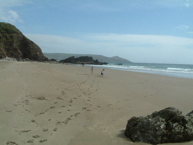
Tregonhawke Beach is the largest of the beaches within Whitsand Bay, with a length ogfaround 2.5km (1.5 miles). The beach is a sandy beach with rocks and at low tide you have a massive expanse of sand but when the tide is high then the beach all but disappears. You also need to be careful as high tide can cut Read more…
Freathy beach is a sandy south facing sun trap just below the village of Freathy at the mid-point of Whitsand Bay. Lifeguards present daily during July, August and September and the beach has a small cafe. Car parking is available at Sharrow Point nearby and in lay-bys along the coast road. Read more…
Sharrow Beach also known as The Grotto is a good sandy beach with rock pools. The beach is really divided into smaller coves due to small outcrops of rocks which makes it a necessity to keep an eye on the tides as high tide areas can be cut off. The name Grotto comes from the National Trust property which preserves Read more…
Little Escape is one of seven beach huts overlooking Towan Beach in Newquay, Cornwall. The hut has electric lighting, power sockets and heating along with being located within a secure gated complex that has a tap suitable for drinking and communal seating area. There is a shower on the beach. The hut is available for day use only and can Read more…
Porthgwidden Beach currently has 39 chalets which are available to hire on a weekly or seasonal basis. Located on the beach with views out over St.Ives bay towards Godrevy Lighthouse and Hayle beaches. Porthgwidden Beach is in the heart of St. Ives with access to all of the towns shops and places to eat. Read more…
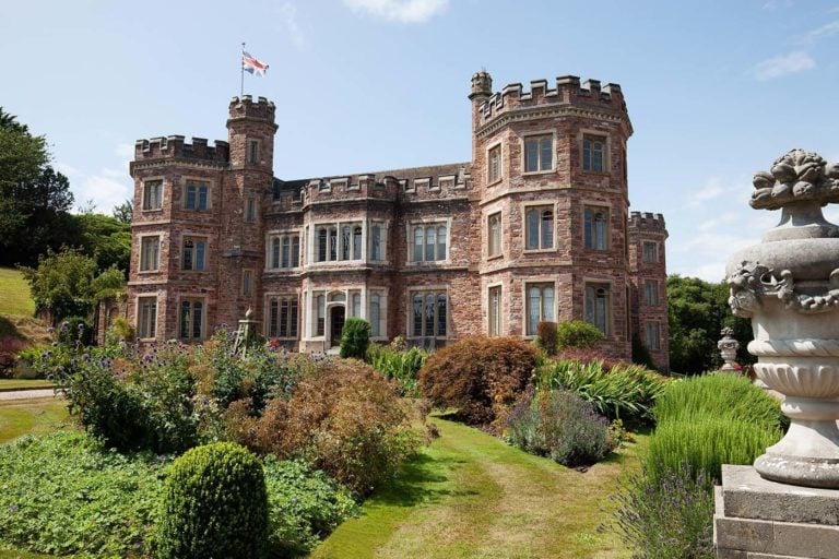
Mount Edgcumbe House is the former home of the Earls of Mount Edgcumbe, first built in the 1500s. Set in Grade I Cornish Gardens within 865 acres Country Park. Read more…
St George’s Island is also known as Looe Island, a small island about a mile offshore from Looe in Cornwall. Owned and managed by the Cornwall Wildlife Trust charity. The Island is approx. 22.5 acres (9 ha) in area and a mile (1.6 km) in circumference with the highest point being only 47 metres (154 ft). The landing fees and other income is Read more…
Looe lifeboat station was established in 1866 but then closed in 1930. The station was opened again in 1992 and now operates two inshore lifeboats. Station open daily whilst shop open daily between Easter and late December. Read more…