Advertisement
Alum Bay Beach
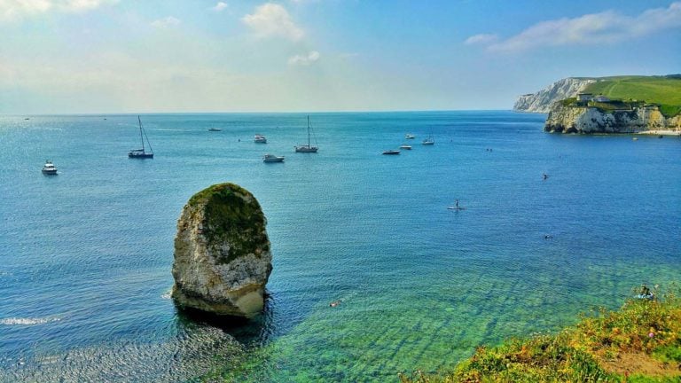
Alum Bay lies at the western most point of the Isle of Wight and you can see the Needles quite clearly here. One of the things tourists love is the varied coloured sands of the cliffs and it is still possible to get the layered sands in tiny bottles in the gift shops in the nearly towns and villages.
This is a pebble beach and great for beach walks, shell and fossil hunting. Boat trips are run from a jetty on the beach and the facilities are good with a car park, toilets and a cafe.
The chalk downs around Alum Bay are fantastic walking country.
Dog Friendly Beach?
Dogs are allowed but must be kept on leads.
Why not check other beaches nearby as we have 29 beaches in Isle of Wight, or check our list of Isle of Wight Dog Friendly Beaches.
Visit Alum Bay Beach
Alum Bay Beach, Totland, Totland, Isle of Wight , United Kingdom
No Records Found
Sorry, no records were found. Please adjust your search criteria and try again.
Maps failed to load
Sorry, unable to load the Maps API.
(Get directions)
7 Day Weather Forecast
Totland weather forecast from Yr, delivered by the Norwegian Meteorological Institute and NRK
Alum Bay Beach Tide Times
Tide times are available at around 600 locations and the closest location to Alum Bay Beach is at Totland Bay 2.13 km (1.32 miles) away. Tides are displayed beneath for up to 7 days and we list both high and low water times along with the height. These times are not adjusted for BST.
Mon 06 Feb
High Tide at 00:40 (Height 2.44m)
Low Tide at 04:15 (Height 0.98m)
High Tide at 10:20 (Height 2.34m)
Low Tide at 16:35 (Height 0.69m)
Tue 07 Feb
High Tide at 01:15 (Height 2.40m)
Low Tide at 04:50 (Height 0.96m)
High Tide at 10:47 (Height 2.38m)
Low Tide at 17:08 (Height 0.66m)
High Tide at 23:27 (Height 2.40m)
Wed 08 Feb
Low Tide at 05:24 (Height 0.95m)
High Tide at 11:25 (Height 2.40m)
Low Tide at 17:40 (Height 0.67m)
Thu 09 Feb
High Tide at 00:03 (Height 2.42m)
Low Tide at 05:59 (Height 0.95m)
High Tide at 12:06 (Height 2.37m)
Low Tide at 18:14 (Height 0.70m)
Fri 10 Feb
High Tide at 00:44 (Height 2.42m)
Low Tide at 06:36 (Height 0.98m)
High Tide at 12:50 (Height 2.31m)
Low Tide at 18:50 (Height 0.77m)
Sat 11 Feb
High Tide at 01:29 (Height 2.38m)
Low Tide at 07:15 (Height 1.03m)
High Tide at 13:37 (Height 2.22m)
Low Tide at 19:29 (Height 0.87m)
Sun 12 Feb
High Tide at 02:17 (Height 2.32m)
Low Tide at 07:59 (Height 1.10m)
High Tide at 14:27 (Height 2.12m)
Low Tide at 20:13 (Height 1.01m)
Contains ADMIRALTY® tidal data: © Crown Copyright and database right.
You may also like ...
In this 'you may also like' section we attempt to answer what else can I do? Here you have a list by order of being the closest some more beaches, things to see and do, accommodation, places to eat and upcoming events.
Where to stay ...
Booking.com
Beach: Gurnard Beach, Cowes View: Situated right on the beach next to the Gurnard Sailing Club with stunning views over Cowes and out to sea. What’s on the menu?: Breakfasts, baguettes, light bites, hot and cold drinks, cakes and desserts. Fully licensed.
Read more…
Beach: Ventnor Beach View: Overlooking the family-friendly sandy bay at Ventnor What’s on the menu?: Breakfasts, snacks, sandwiches, fresh seafood, cream teas, hot and cold drinks, ice-creams. To eat in or take away.
Read more…
The Crabb Inn is a family-friendly thatched pub in the heart of the old village of Shanklin. Serving a wide variety of food all day every day.
Read more…
Beach: The blue flag Sandown beach View: Situated right on the beach on the western edge of Sandown seafront, looking out over the beautiful, sandy bay towards the downs at Ventnor. What’s on the menu?: A Mediterranean style café with an emphasis on great seafood. Their crab cakes are well-known!
Read more…
Totland Bay Beach is ideal for families who want a sheltered sandy beach where they can relax and enjoy a picnic and a sunbathe and paddle. It is a clean beach with sand and shingle with a tree line backdrop and steps taking you up to amusements, cafes, shops, camping and huts. A great beach for swimming, wind surfing and
Read more…
Colwell Bay beach is sandy and popular with the locals. The beach itself is gently sloping into the sea which is great for families with kids but be careful of the steps a bit further around the bay which may be slippery. There are beach huts to rent on the promenade and a lovely beach cafe with a terrace giving
Read more…
Freshwater Bay is open to the Channel and takes the brunt of the prevailing winds in the winter months. At Freshwater you can see the rolling waves coming in from the Channel, crashing against the cliffs. In the summer months, however, the waters are calm and still and where the beach is pebbly, the waters are clear. Families are attracted
Read more…
Norton beach is on the other side of the harbour to Yarmouth and is situated between Fort Victoria and Yarmouth. Limited access via car but can use harbour ferry. For facilities you will have to go to either Norton or Yarmouth.
Read more…
The Needles Batteries are on the westerly point of the Isle of Wight and were constructed between 1861-95 for the coastal defence of England. The overlook the Needles, a famous coastal and played a really important part in both world wars. The new Battery has been used more recently to test the Black Knight and Black Arrow space rocket engines and
Read more…
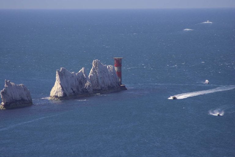
Needles Lighthouse is set in the western approaches to the Isle of Wight, the Needles form a narrow chalky peninsula that rises from jagged rocks to 120m cliffs. These rocks have always been a hazard to ships making their way up the Solent to Portsmouth and Southampton Water.
Read more…
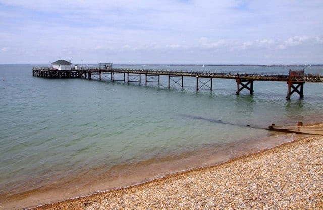
Totland Bay Pier pier is 140m long, constructed of a light girder framework on cast iron piles and a timber deck in the late 1870s. The pier has a cafe with seasonal openings.
Read more…
Yarmouth lifeboat station was established in 1924 after it moved from Totland Bay. The station operates an all weather lifeboat. Station only open by appointment, shop open daily.
Read more…