Advertisement
St Marys Well Bay Beach
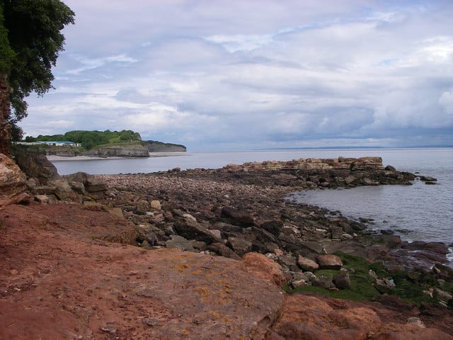
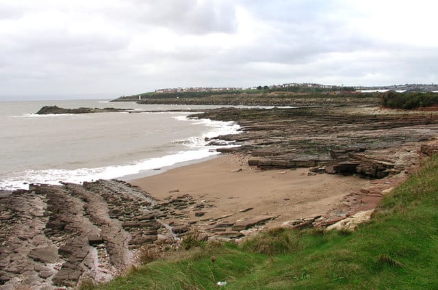
St Marys Well Bay is a combination of coarse sand and pebbles. The beach is backed by Triassic sandstone and limestone cliffs with some great coast walks.
At low tide a sandbar runs parallel to the main beach and extends towards Sully Island.
Roadside parking is available just before the holiday park entrance.
Dog Friendly Beach?
We have no current information on dog restrictions for St Marys Well Bay Beach.
Why not check other beaches nearby as we have 13 beaches in Vale of Glamorgan, or check our list of Vale of Glamorgan Dog Friendly Beaches.
Visit St Marys Well Bay Beach
St Marys Well Bay Beach, Sully, Penarth, Vale of Glamorgan , United Kingdom
No Records Found
Sorry, no records were found. Please adjust your search criteria and try again.
Maps failed to load
Sorry, unable to load the Maps API.
(Get directions)
7 Day Weather Forecast
Penarth weather forecast from Yr, delivered by the Norwegian Meteorological Institute and NRK
St Marys Well Bay Beach Tide Times
Tide times are available at around 600 locations and the closest location to St Marys Well Bay Beach is at Flat Holm 5.22 km (3.25 miles) away. Tides are displayed beneath for up to 7 days and we list both high and low water times along with the height. These times are not adjusted for BST.
Sat 25 Mar
Low Tide at 03:28 (Height 0.79m)
High Tide at 09:19 (Height 12.12m)
Low Tide at 15:40 (Height 1.01m)
High Tide at 21:33 (Height 11.68m)
Sun 26 Mar
Low Tide at 03:47 (Height 1.32m)
High Tide at 09:49 (Height 11.38m)
Low Tide at 15:56 (Height 1.53m)
High Tide at 21:59 (Height 10.97m)
Mon 27 Mar
Low Tide at 04:02 (Height 1.78m)
High Tide at 10:17 (Height 10.52m)
Low Tide at 16:14 (Height 2.00m)
High Tide at 22:25 (Height 10.18m)
Tue 28 Mar
Low Tide at 04:24 (Height 2.25m)
High Tide at 10:46 (Height 9.59m)
Low Tide at 16:40 (Height 2.55m)
High Tide at 22:56 (Height 9.32m)
Wed 29 Mar
Low Tide at 04:55 (Height 2.88m)
High Tide at 11:23 (Height 8.64m)
Low Tide at 17:17 (Height 3.25m)
High Tide at 23:39 (Height 8.44m)
Thu 30 Mar
Low Tide at 05:44 (Height 3.61m)
High Tide at 12:33 (Height 7.82m)
Low Tide at 18:26 (Height 3.93m)
Fri 31 Mar
High Tide at 01:32 (Height 7.83m)
Low Tide at 07:23 (Height 4.07m)
High Tide at 14:50 (Height 7.85m)
Low Tide at 20:17 (Height 3.99m)
Contains ADMIRALTY® tidal data: © Crown Copyright and database right.
You may also like ...
In this 'you may also like' section we attempt to answer what else can I do? Here you have a list by order of being the closest some more beaches, things to see and do, accommodation, places to eat and upcoming events.
Where to stay ...
Booking.com
The Bears Head is a Wetherspoon pub in Penarth, Vale of Glamorgan. Our pub offers a range of real ales, craft beers and freshly ground Lavazza coffee. Breakfast is served until noon, with our full food menu available until 11 pm.
Read more…
The Sir Samuel Romilly is a Wetherspoon pub in Barry, Vale of Glamorgan. Our pub offers a range of real ales, craft beers and freshly ground Lavazza coffee. Breakfast is served until noon, with our full food menu available until 11 pm.
Read more…
Bendricks beach is a small sandy beach with the Triassic formations at Bendrick Rock. No facilities but you should be able to find parking on the road within Atlantic Trading Estate.
Read more…
Jacksons Bay beach is a secluded bay, backed by cliffs with one end being formed by the breakwater at the entrance to Barry Docks. Often overlooked by most people who stay on the larger beaches next door. Take the concrete footpath running from the east end of Whitmore Bay along the cliff top and you will eventually come to Jackson’s Bay.
Read more…
Whitmore Bay is huge sandy beach that lies between the two peninsulas of Friar’s Point and Nell’s Point. As the tide goes out you get more sand to play on. Whitmore Bay is the main Barry Island beach and is between the smaller Jackson’s Bay around Nell’s Point and the Little Island or Old Harbour beach around Friar’s Point. Whitmore
Read more…
The two main beaches on Barry Island are Whitmore Bay between the two peninsulas of Friar’s Point and Nell’s Point, and the other is the smaller and secluded Jackson’s Bay around the headland and cliffs, connected by Clement Coley Walk. Little Island beach sits on the far side of Friar’s Point round near the old harbour, this is sometimes referred
Read more…
Barry Island has 24 vibrantly coloured beach huts with excellent views across Whitmore Bay. The huts come in two sizes: larger huts are around 2.4m x 2.5m and have electricity sockets and access to running water smaller huts are around 2.5m x 1.8m. and have electricity sockets Hours are 10 am to 8 pm with July/August school holidays being 10
Read more…
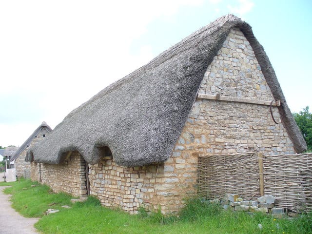
Cosmeston Medieval Village is a restored and reconstructed village from the medieval period situated near Lavernock in the Vale of Glamorgan. It was when the Cosmeston Lakes Country Park was being developed in the late 1970s that the archeological trust uncovered evidence of a 600-year-old village. Today visitors can travel back in time to 1350 to see how life was
Read more…
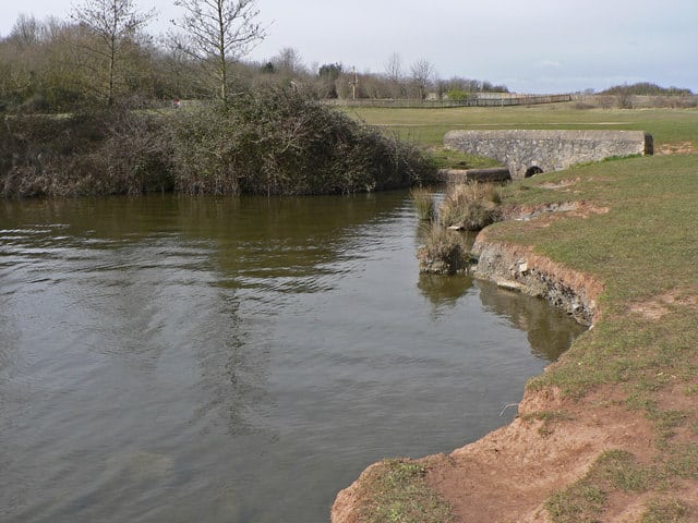
Cosmeston Lakes Country Park is a country park open to the public located between Penarth and Sully in the Vale of Glamorgan. Enjoy nearly 250 acres of Lakeland, woodland and lovely country walks. Right at the centre of the Park is a large lake which is used for many water sports and is a good place to watch the bird-life.
Read more…
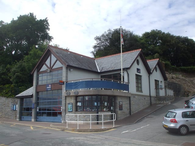
Penarth lifeboat station established in 1861 and now operates two inshore lifeboats. Station is only open by appointment, no shop.
Read more…
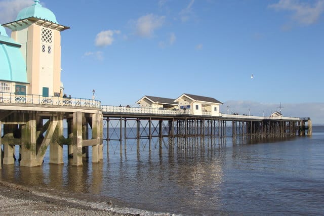
Penarth Pier is one of the last remaining Victorian piers in Wales. The pier opened in February 1895 and the original structure was of cast iron with a timber deck. A wooden pavilion was added to the pier-head in 1907. In the 1920s the pier had enhancements of a reinforced concrete landing stage and an art deco pavilion. On August
Read more…