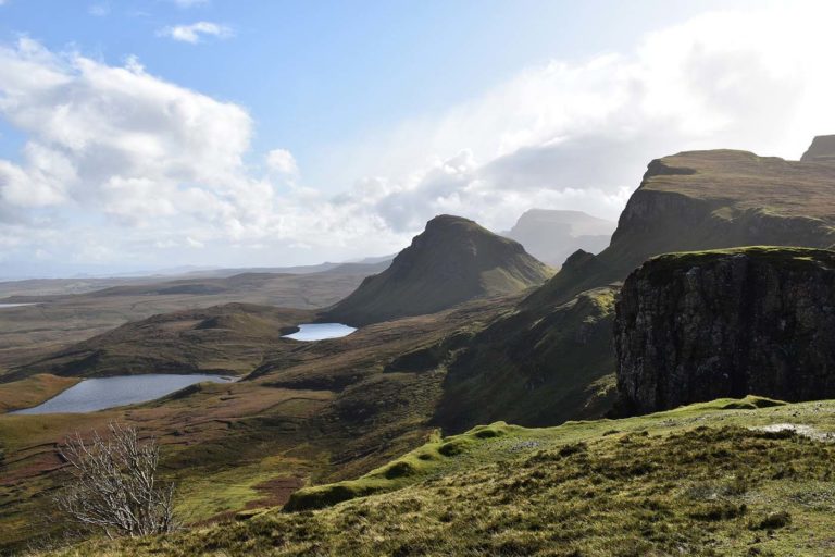
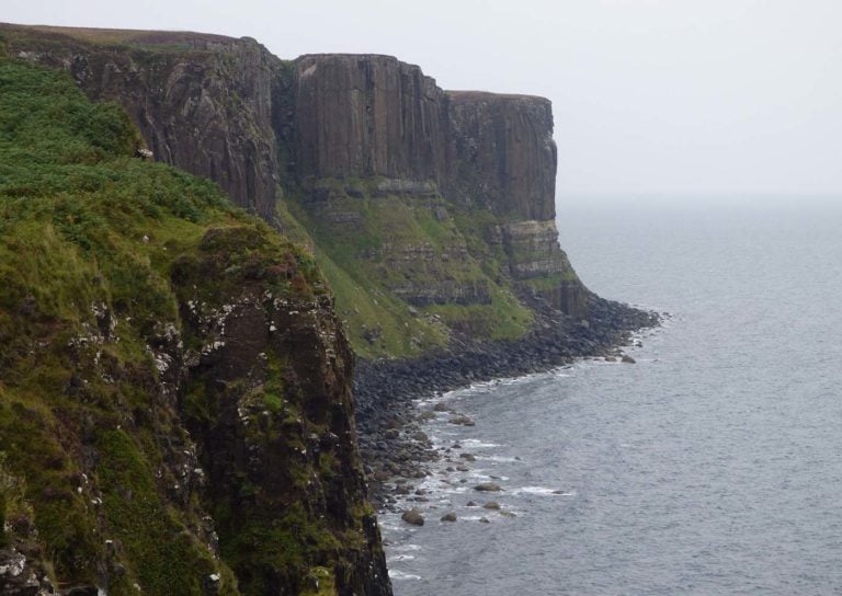
Places Map Loading… Not visited here yet! Sorry, we are yet to populate places in this area. Maps failed to load Sorry, unable to load the Maps API. Popular Places 123Older posts Showing Places 1-12 of 29 Favourite Caisteal Maol Caisteal Maol or Castle Moal is a ruined castle situated on a headland above the village of Kyleakin on the Read more… Place Tags: Outdoors – Nature Favourite Kyleakin Kyleakin is a village on the east coast of the Isle of Skye. Its name comes from the Norwegian, as Read more… Favourite Glendale Glendale is a large estate of nearly 19 000 acres near to Dunvegan in the north-western corner of the Isle Read more… Favourite Teangue Teangue is a fishing village situated on the Sleat peninsula in the south-western corner of the Isle of Skye. The Read more… Favourite Skye Museum of Island Life The Skye Museum of Island Life is an open-air museum in Kilmuir in the north-east corner of the Isle of Read more… Place Tags: Museums Favourite Trumpan Church Trumpan Church is a ruined building in the hamlet of Trumpan on the Vaternish peninsula in the north of the Read more… Favourite Quiraing The Quiraing is a landslip found on the eastern side of Meall na Suiramach which is on Trotternish Ridge on Read more… Place Tags: Outdoors – Nature Favourite Kilt Rock Kilt Rock is a sea cliff in the northeast of the Trotternish peninsula on the Isle of Skye. The rock Read more… Favourite Am Basteir Am Basteir is a mountain in the northern Cuillin range on the Isle of Skye, at 934 metres high it Read more… Place Tags: Outdoors – Nature Favourite Camas Ban Beach Camas Ban is a sandy beach with the sand having some black within it. No facilities. Read more… Place Tags: Beaches Favourite Claigan Coral Beach Claigan Coral Beach is a fine white sandy beach on the shoreline of Loch Dunvegan. No facilities with access on foot. Read more… Place Tags: Beaches Favourite Portree lifeboat station Portree lifeboat station was established in 1991 and operates an all weather lifeboat. Station is open daily weekdays, no shop. Read more… Place Tags: Lifeboats View: Grid 1 View: Grid 2 View: Grid 3 View: Grid 4 View: Grid 5 View: List 123Older posts Showing Places 1-12 of 29