Musselwick Sands Beach
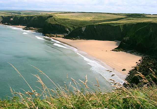
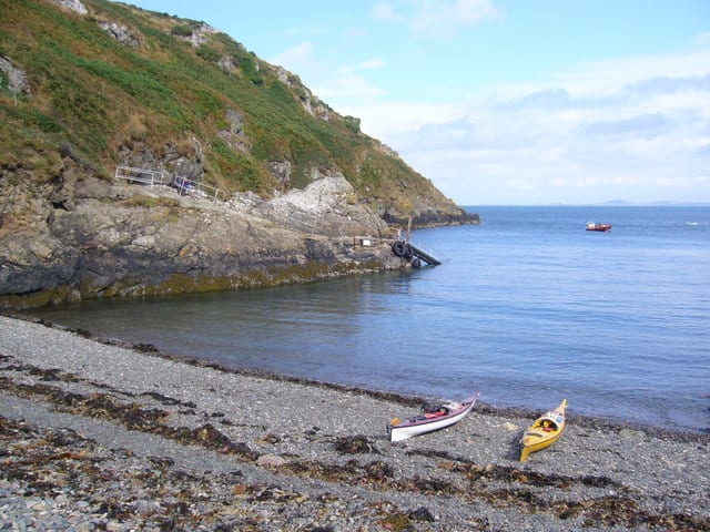
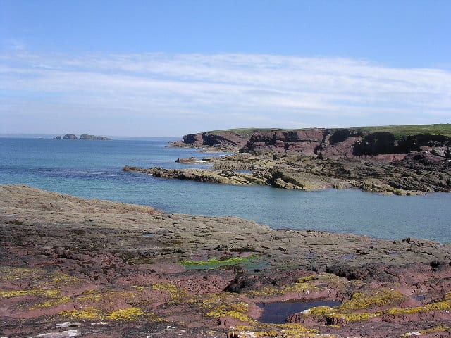
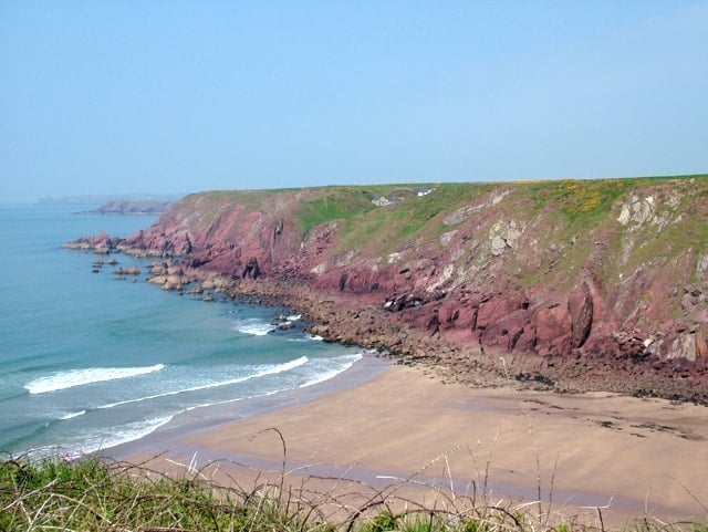
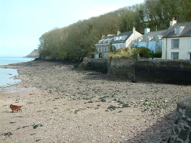
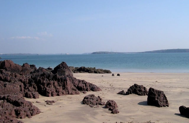
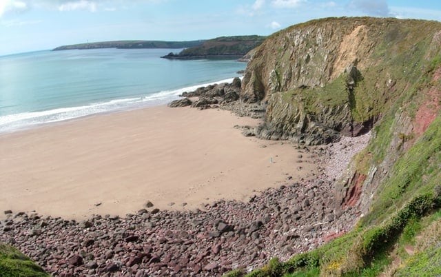
Musselwick Sands beach is a strip of golden sands with views of St. Davids Peninsula. The sand disappears at high tide but this beach is quiet and secluded due to the difficult access.
Limited roadside parking and then roughly a 10 minute walk. To get down on to the beach you have steps cut into the rock.
Dog Friendly Beach?
We have no current information on dog restrictions for Musselwick Sands Beach.
Why not check other beaches nearby as we have 54 beaches in Pembrokeshire, or check our list of Pembrokeshire Dog Friendly Beaches.
Planning your visit to Musselwick Sands Beach
Musselwick Sands Beach, Marloes, Dale, Pembrokeshire SA62 3BJ, United Kingdom
No Records Found
Sorry, no records were found. Please adjust your search criteria and try again.
Maps failed to load
Sorry, unable to load the Maps API.
(Get directions)
Musselwick Sands Beach 7 Day Weather Forecast
Dale weather forecast from Yr, delivered by the Norwegian Meteorological Institute and NRK
Musselwick Sands Beach Tide Times
Tide times are available at around 600 locations and the closest location to Musselwick Sands Beach is at Martin's Haven 2.76 km (1.72 miles) away. Tides are displayed beneath for up to 7 days and we list both high and low water times along with the height, helping you to plan the best time to visit Musselwick Sands Beach. These times are not adjusted for BST.
Thu 28 Sep
High Tide at 05:16 (Height 6.08m)
Low Tide at 11:38 (Height 0.95m)
High Tide at 17:35 (Height 6.49m)
Fri 29 Sep
Low Tide at 00:04 (Height 0.56m)
High Tide at 05:59 (Height 6.41m)
Low Tide at 12:22 (Height 0.59m)
High Tide at 18:18 (Height 6.75m)
Sat 30 Sep
Low Tide at 00:46 (Height 0.34m)
High Tide at 06:41 (Height 6.58m)
Low Tide at 13:03 (Height 0.43m)
High Tide at 19:00 (Height 6.82m)
Sun 01 Oct
Low Tide at 01:26 (Height 0.33m)
High Tide at 07:20 (Height 6.59m)
Low Tide at 13:43 (Height 0.47m)
High Tide at 19:40 (Height 6.72m)
Mon 02 Oct
Low Tide at 02:04 (Height 0.54m)
High Tide at 07:58 (Height 6.44m)
Low Tide at 14:20 (Height 0.72m)
High Tide at 20:19 (Height 6.45m)
Tue 03 Oct
Low Tide at 02:40 (Height 0.92m)
High Tide at 08:35 (Height 6.17m)
Low Tide at 14:57 (Height 1.14m)
High Tide at 20:56 (Height 6.05m)
Wed 04 Oct
Low Tide at 03:15 (Height 1.42m)
High Tide at 09:11 (Height 5.80m)
Low Tide at 15:33 (Height 1.67m)
High Tide at 21:34 (Height 5.58m)
Contains ADMIRALTY® tidal data: © Crown Copyright and database right.
You may also like ...
In this 'you may also like' section we attempt to answer what else can do near Musselwick Sands Beach? Here you have a list by order of being the closest some more beaches, things to see and do, places to eat and upcoming events.
The William Owen is a Wetherspoon pub in Haverfordwest, Pembrokeshire. Our pub offers a range of real ales, craft beers and freshly ground Lavazza coffee. Breakfast is served until noon, with our full food menu available until 11 pm.
Read more…
The Point Cafe sits in the village of Pendine alongside Pendine Sands. Simple menu with the option to take away or eat at one of the tables overlooking the beach.
Read more…
The Waters Edge Cafe serves breakfast, lunch, dinner, coffee and drinks. Good for children, outdoor seating with beach views, takeaways and no need to book.
Read more…
Yr Hen Dderwen is a Wetherspoon pub in Carmarthen, Carmarthenshire. Our pub offers a range of real ales, craft beers and freshly ground Lavazza coffee. Breakfast is served until noon, with our full food menu available until 11 pm.
Read more…
Marloes Sands beach is a 2km long sandy beach that all but disappears at high tide when you are left with a pebble bank. Marloes Sands faces south east into the Bristol Channel, towards Stockholm island. You have some rocks that provide some interesting rock pools to explore but as the beach disappears at high tide you need to plan
Read more…
Martins Haven beach is a small pebble beach. Facilities include a National Trust car park and toilets. This is a popular location for boats to Skomer Island and in partiocular for divers heading out into the Skomer Marine Nature Reserve.
Read more…
St Brides Haven beach is a small sheltered sand, shingle and rocky bay on the Pembrokeshire Coast with plenty of rock pools to explore. Facilities include parking and toilets although nearby you have the village of Marloes that has a pub.
Read more…
Westdale Bay close to the village of Dale with a footpath leading down a steep grassy bank to a sandy beach surrounded by cliffs. There are no facilities at the beach, but the nearby village of Dale offers shops. Parking is limited along the roadside, from where it is a 10 minute walk along the coast path to the beach.
Read more…
Dale Fort is a mid-19th century coastal artillery fort at Dale Head, Pembrokeshire. The fort occupies the easternmost end of the promontory and is protected by a ditch cut into the rock. The ditch stretches across the promontory and down to the shoreline on either side. The landward (western) side of the fort facing the ditch consists of a loopholed wall, in the centre
Read more…
Skomer Island lies off the coast of Pembrokeshire in south-western Wales. Covering 1.13 square miles in area, the island is renowned for its amazing wildlife and is a National Nature Reserve as well as a Site of Specific Scientific Interest. A third of the population of Manx Shearwaters nest here, with Atlantic puffins and many other seabirds also congregating in
Read more…
Milford Haven has long been recognised by merchants and shipowners as one of Britain’s finest deep water harbours – it was from here that Henry II led his army into Ireland in 1172. Now large fleets of trawlers and oil tankers gather in the anchorage. At the approach to this famous port lie dangerous reefs just below the surface, almost
Read more…
The small island of Skokholm, just 1¼ miles long by ½ mile wide, lies just off the Pembrokeshire coast, and the lighthouse is situated on the South West point of the island. The island has high cliffs rising sheer from the sea to well over 30 metres in many places, and a great variety of bird life is to be
Read more…