Advertisement
Loch Linnhe Beach
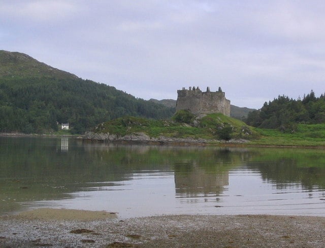
Loch Linnhe is 50 km (31 miles) long and is one of Scotlands longest sea lochs. This is a small shingle beach area by the Pier at Fort William.
The Pier stretches 800m and is used as an underwater traiming centre.
Dog Friendly Beach?
We have no current information on dog restrictions for Loch Linnhe Beach.
Why not check other beaches nearby as we have 41 beaches in The Scottish Highlands, or check our list of The Scottish Highlands Dog Friendly Beaches.
Visit Loch Linnhe Beach
Loch Linnhe Beach, Fort William, Fort William, The Scottish Highlands , United Kingdom
No Records Found
Sorry, no records were found. Please adjust your search criteria and try again.
Maps failed to load
Sorry, unable to load the Maps API.
(Get directions)
7 Day Weather Forecast
Fort William weather forecast from Yr, delivered by the Norwegian Meteorological Institute and NRK
Loch Linnhe Beach Tide Times
Tide times are available at around 600 locations and the closest location to Loch Linnhe Beach is at Corpach 3.25 km (2.02 miles) away. Tides are displayed beneath for up to 7 days and we list both high and low water times along with the height.
Wed 08 Feb
Low Tide at 01:56 (Height 0.74m)
High Tide at 07:37 (Height 3.91m)
Low Tide at 14:28 (Height 1.04m)
High Tide at 19:56 (Height 3.76m)
Thu 09 Feb
Low Tide at 02:22 (Height 0.77m)
High Tide at 08:02 (Height 3.86m)
Low Tide at 14:50 (Height 1.10m)
High Tide at 20:20 (Height 3.66m)
Fri 10 Feb
Low Tide at 02:46 (Height 0.84m)
High Tide at 08:27 (Height 3.78m)
Low Tide at 15:06 (Height 1.19m)
High Tide at 20:44 (Height 3.55m)
Sat 11 Feb
Low Tide at 03:12 (Height 0.94m)
High Tide at 08:54 (Height 3.67m)
Low Tide at 15:29 (Height 1.29m)
High Tide at 21:15 (Height 3.41m)
Sun 12 Feb
Low Tide at 03:43 (Height 1.07m)
High Tide at 09:26 (Height 3.53m)
Low Tide at 16:03 (Height 1.42m)
High Tide at 21:51 (Height 3.25m)
Mon 13 Feb
Low Tide at 04:24 (Height 1.24m)
High Tide at 10:07 (Height 3.33m)
Low Tide at 16:51 (Height 1.57m)
High Tide at 22:37 (Height 3.08m)
Tue 14 Feb
Low Tide at 05:18 (Height 1.41m)
High Tide at 11:01 (Height 3.11m)
Low Tide at 18:04 (Height 1.68m)
High Tide at 23:48 (Height 2.93m)
Contains ADMIRALTY® tidal data: © Crown Copyright and database right.
You may also like ...
In this 'you may also like' section we attempt to answer what else can I do? Here you have a list by order of being the closest some more beaches, things to see and do, accommodation, places to eat and upcoming events.
Where to stay ...
Booking.com
The King’s Highway is a Wetherspoon hotel in Inverness, Highland. Our pub offers a range of real ales, craft beers and freshly ground Lavazza coffee. Breakfast is served until noon, with our full food menu available until 11 pm.
Read more…
The Links Tea Room is located on Nairn beach and offers the usual tea, coffee, cake and hot food. You have a choice of inside and outside seating areas.
Read more…
The Cafe at Bettyhill is open to serve lunch, dinner and coffee 6 days a week during the summer months. Food consists of light lunches, fish and chips, home baking, coffee and teas, and we also have a craft shop upstairs. As well as the summer months we are open on a Friday and Saturday evening all year round as
Read more…
The Farr Bay Inn is ideally located a few minutes walk from Farr beach and 15 minutes from Bettyhill. Each room includes a flat-screen TV with Amazon Fire TV, Netflix, on Demand Viewing and tea and coffee making facilities. The private bathrooms have complimentary toiletries and a hairdryer. Free WiFi is available throughout. As well as offering accommodation the Farr Bay
Read more…
The white sands are hidden from view by sand dunes which you have to walk through to reach it. Featured in the film Local Hero. You can even get married on the beach!
Read more…
Avoch Bay is a small sand and shingle bay. Avoch is an attractive coastal village with a small harbour overlooking Avoch Bay and the Moray Firth on the south side of the peninsula called ‘The Black Isle’. Avoch is a small village with places to eat.
Read more…
Red Point by Gairloch has two sandy remote beaches backed by dunes with great views out to the islands on a fine day. The North beach (marked on our map) is the larger and wider of the two beaches that are often referred to as Red Point North and Red Point South beaches. Access is by a single track road.
Read more…
Fortrose beach is a sand and shingle beach that stretches from Fortrose harbour to Chanonry Point. Fortrose is located on the southern coast of the Black Isle overlooking the sheltered waters of the Moray Firth.
Read more…
The Great Glen Way is a walking route of 79 miles, running from Fort William on the shore of Loch Linnhe north-eastwards, following the Great Glen Fault, to Inverness. Most of the route closely follows the line of the Caledonian Canal. For more information on the Great Glen way and to download maps of all or parts of the route,
Read more…
Ben Nevis is the highest mountain in the British Isles, standing at 1,345 metres (4,411 ft), it is located at the western end of the Grampian Mountains in the Lochaber area of the Scottish Highlands, close to the town of Fort William.
Read more…
The Ice Factor is The National Centre for Ice Climbing is home to the largest indoor ice climbing wall in the world. As well as ice climbing the centre offers indoor rock climbing walls, bouldering area, outside aerial adventures around a 250m circuit 10m above the ground and outdoor rock climbing courses. The centre also has a shop, cafe, bar
Read more…
Our eco-friendly visitor centre, your gateway to exploring Glencoe. Including exhibition, viewing platform, cafe, shop and ranger information point. The Ranger service has a varied events programme with guided walks, Landrover safaris and children’s events.
Read more…