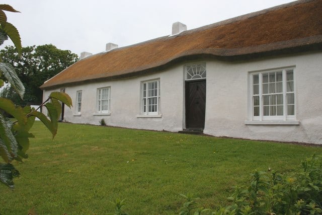
Places Map Loading… Not visited here yet! Sorry, we are yet to populate places in this area. Maps failed to load Sorry, unable to load the Maps API. Popular Places Favourite Springhill Springhill, a pretty 17th-century ‘Plantation’ home with a collection of costumes, from the 18th century to 1930s. Read more… Favourite Magilligan Beach Magilligan Beach (Benone Strand) is located on the North West corner of Northern Ireland and stretches for 7 miles from Read more… Place Tags: Beaches and Blue Flag Awards Favourite Castlerock Beach Castlerock beach is a mile of sandy beach backed by grass covered dunes that runs west-wards from the mouth of Read more… Place Tags: Beaches and Blue Flag Awards Favourite Downhill Beach Downhill beach offers visitors a long stretch of sandy beach with great surf making it an ideal spot for water Read more… Place Tags: Beaches and Blue Flag Awards Favourite Magilligan Point Beach Magilligan Point is the tip of one of the largest (7 miles) sand dune systems in the British Isles. The Read more… Place Tags: Beaches Favourite Hezlett House Hezlett House, 17th-century thatched cottage and garden which was built in 1691 but bought by Isaac Hazlett in 1776. The Read more… Place Tags: History – Heritage Favourite Banagher Old Church Banagher Church sits on a sandy ridge by the River Owenreagh, the ruins are of a small square building with Read more… Place Tags: History – Heritage Favourite Portstewart Strand Beach The Strand at Portstewart is a large sandy beach backed by a sand dune system that reaches heights of up Read more… Place Tags: Beaches Favourite Mussenden Temple and Downhill Demesne Stunning Mussenden Temple, perched upon a precipitous cliff edge in a dramatic coastal setting. Cliff-top and garden walks with breathtaking Read more… Favourite Derry City Walls The Derry City Walls are about 1 mile in circumference with the entire length accessible on foot. The wall has Read more… View: Grid 1 View: Grid 2 View: Grid 3 View: Grid 4 View: Grid 5 View: List