
The Raad ny Foillan, Manx Gaelic for ‘Way of the Gull’, is the Isle of Man’s long-distance coast path. At approximately 160 km (100 miles) this coastal footpath takes you around this beautiful and diverse Isle of Man coastline. The path is clearly marked with a White gull on a blue sign with the text ‘RAAD NY FOILLAN’.

The Isle of Man has a lot of diversity from the flat plains in the north, rolling hills in the middle and the rocky shores around the Sound in the south. The Raad ny Foillan coastal footpath is a great way to experience this diversity and beauty.
The path can be walked however you like but we have listed the sections in manageable stages between towns. We didn’t walk the route, we are not long-distance walkers but used the coast path as a way of exploring the area around towns, by visiting a town, the start and finish points of each of the below sections, and then exploring the coastline by following the Raad ny Foillan waymarkers.
We will take you through the sections in clockwise order from Douglas Bay where most people arrive on the ferry. The distances are approximate as you may want to wander off the route to explore views and historical sites.
Douglas to Castletown
Distance: 20.5 km / 12.5 miles
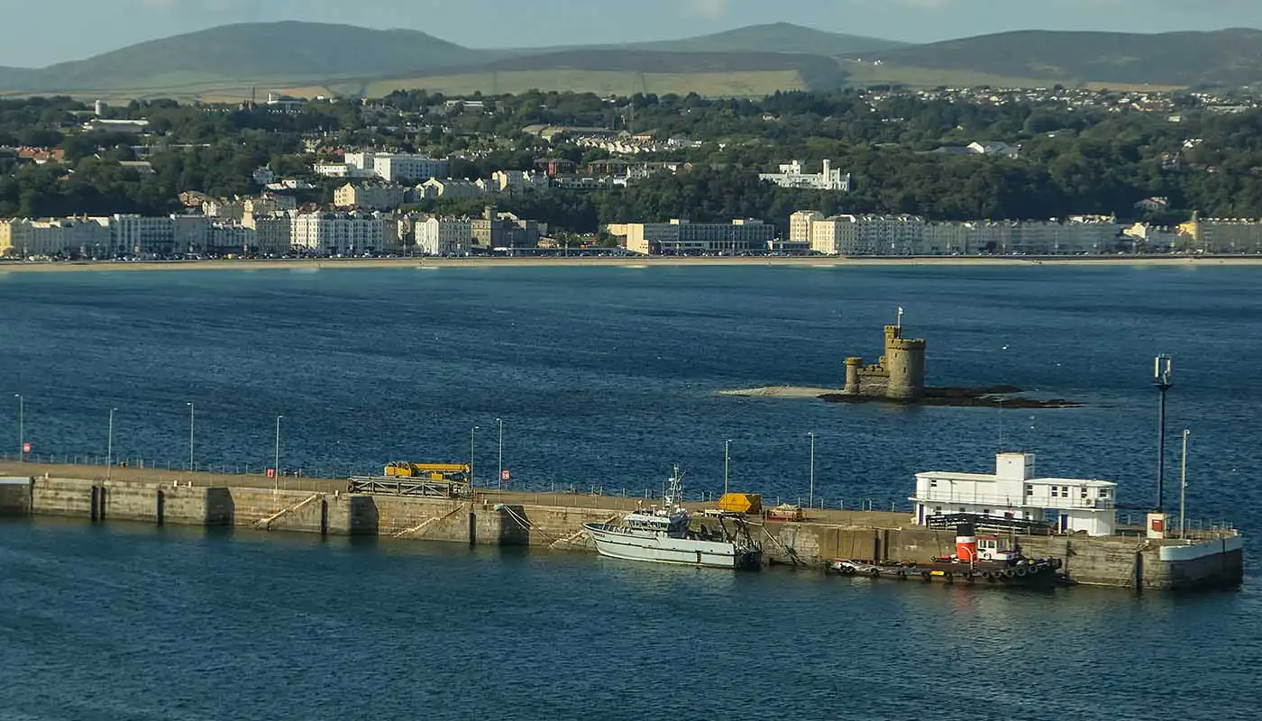
After a climb up to Douglas Head where you can see the lighthouse and visit the Camera Obscura, you will start off following Marine Drive which overlooks the Little Ness Marine Nature Reserve. This route started life as a railway, then a coast road but is now closed to traffic due to erosion. You will finish the Marine Drive stretch at Port Soderick.
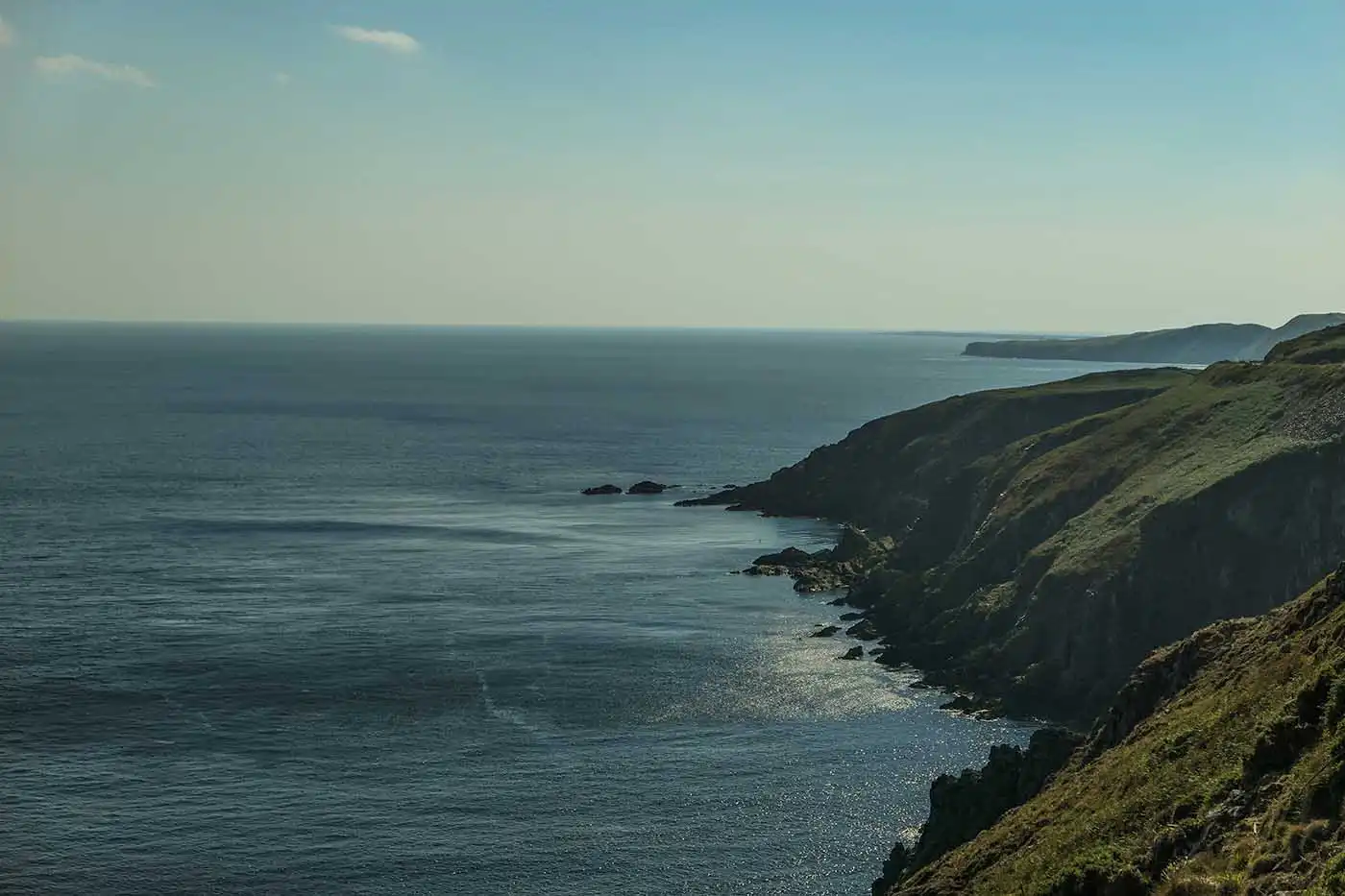
As you continue on your walk you will pass a number of historical sites, one is the Iron Age fort Cronk ny Merriu just by the beach at Port Grenaugh.
As you end this stage you will drop down into Castletown with some great views over Derbyhaven Bay although you need to ignore the airport.
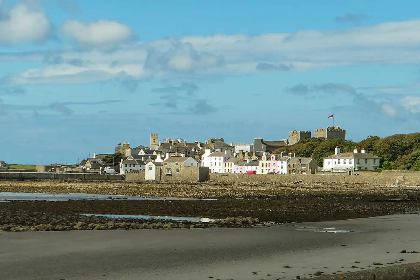
Castletown is the Island’s old capital and has a few sandy bays along with Fort Island. Here you’ll find many places of interest worth exploring including the medieval fortress Castle Rushen, the Old House of Keys and the Nautical Museum.
Castletown to Port St Mary
Distance: 19.5 km / 12 miles
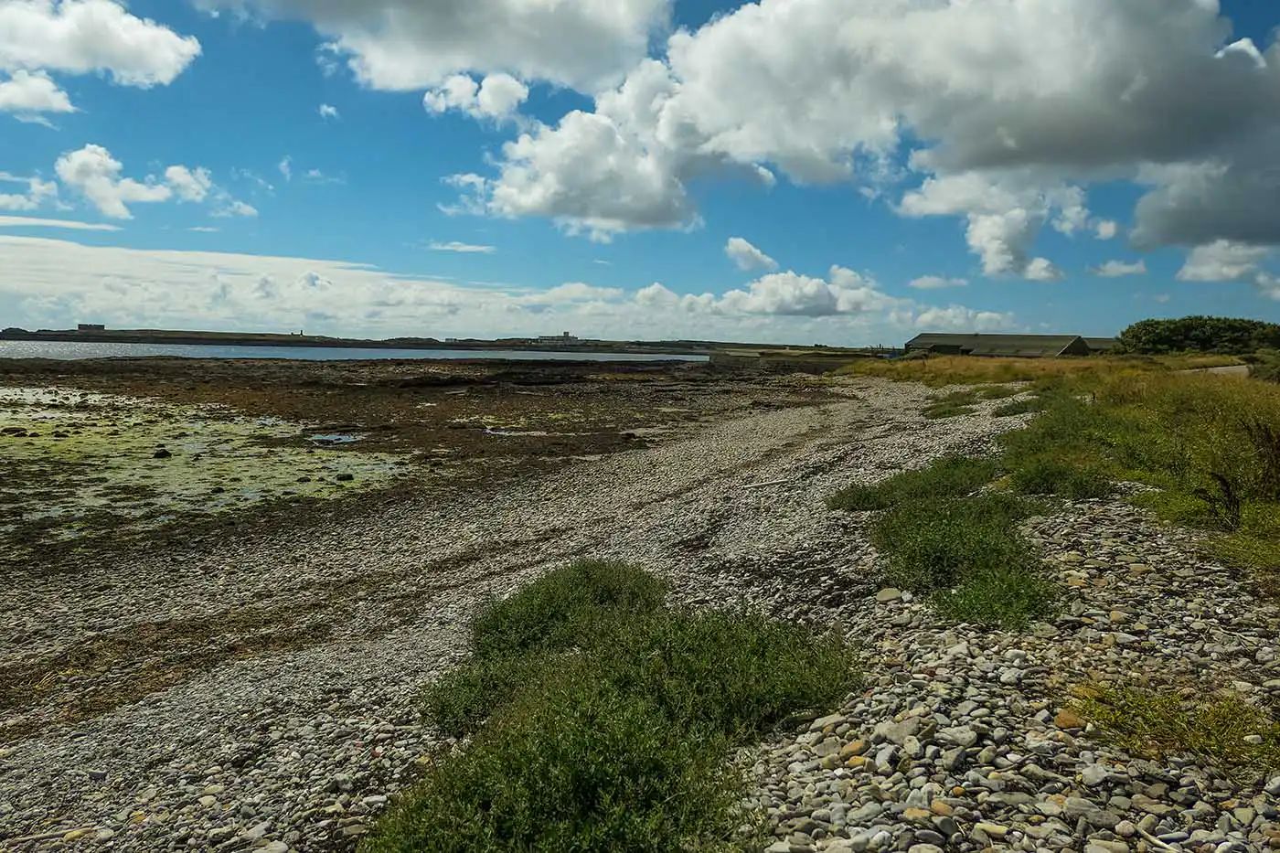
The last stage finished when arriving in Castletown and this stage starts by taking in St Michael’s Island (Fort Island) in Castletown Bay which adds around 5km to this stage and could be added to the day before, combined with a day in Castletown or even skipped. We think it is worth the distance with the old fort and great views.
After St Michael’s Island, it’s time to leave Castletown, you will pass through Scarlett Nature Reserve well worth a visit to the discovery centre sitting amongst the lime kilns and limestone quarry. Continue along the exposed coast to arrive in the sheltered harbour town of Port St Mary.

Port St Mary to Port Erin
Distance: 11 km / 7 miles
This next stage takes you around the southern coast of the Island with some great views, sheer cliffs, historic villages and wonderful wildlife.
This unforgettable section of the Raad ny Foillan offers tremendous opportunities to see a contrast of scenery as well as marine wildlife. The terrain changes as you leave Port St Mary from grassy footpaths to moorland and cliffs. A short detour will take you to the rocky Chasms, which are huge crevices in the sandstone cliffs before arriving at Spanish Head which is one of the island’s best rock climbing locations.
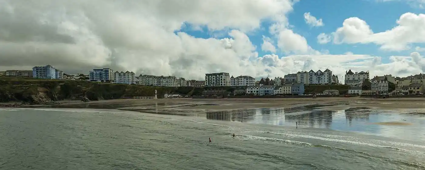
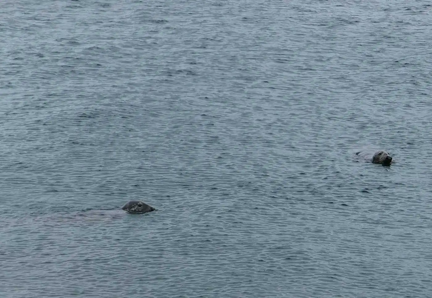
The Sound cafe offers a great spot for a break where you can spot seals and enjoy panoramic views of the Calf of Man whilst having a well-earned hot drink and slab of homemade cake. This is the point where we switch from the east to the west coast and now head northwards along the cliff tops to the victorian resort of Port Erin.
Port Erin to Niarbyl
Distance: 15 km / 9.5 miles
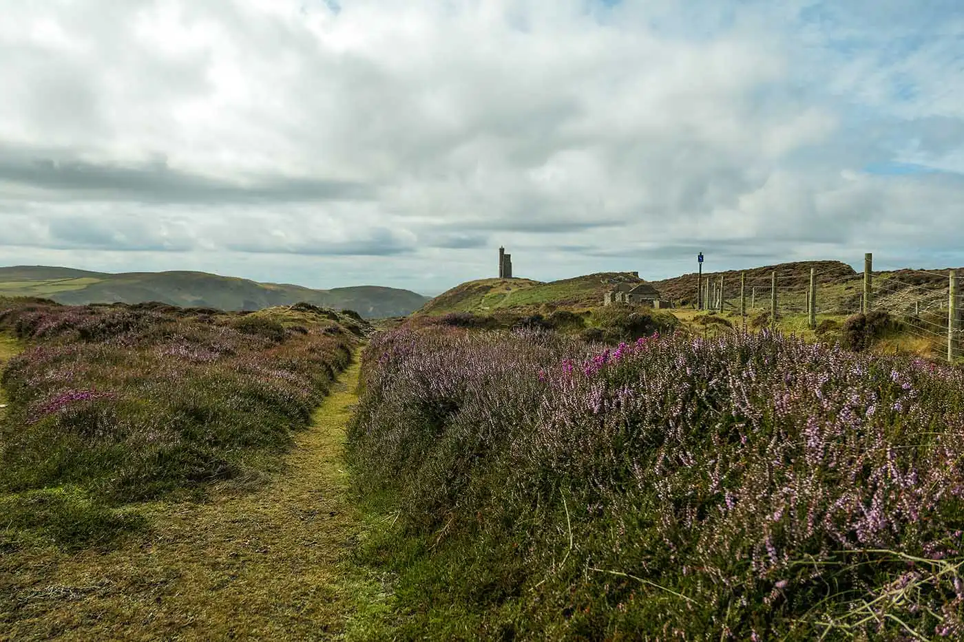
Beginning with a walk around Port Erin Bay you will then head up to Milner’s Tower on Bradda Head where you’ll get stunning views of the Calf of Man. This is spectacular in the mid to late summer when the clifftop heather and gorse are in full bloom.
After taking in the breathtaking scenery you descend down towards the excellent pebble beach at Fleshwick Bay before heading back upward to Lhiattee ny Beinnee at 301m (988ft).

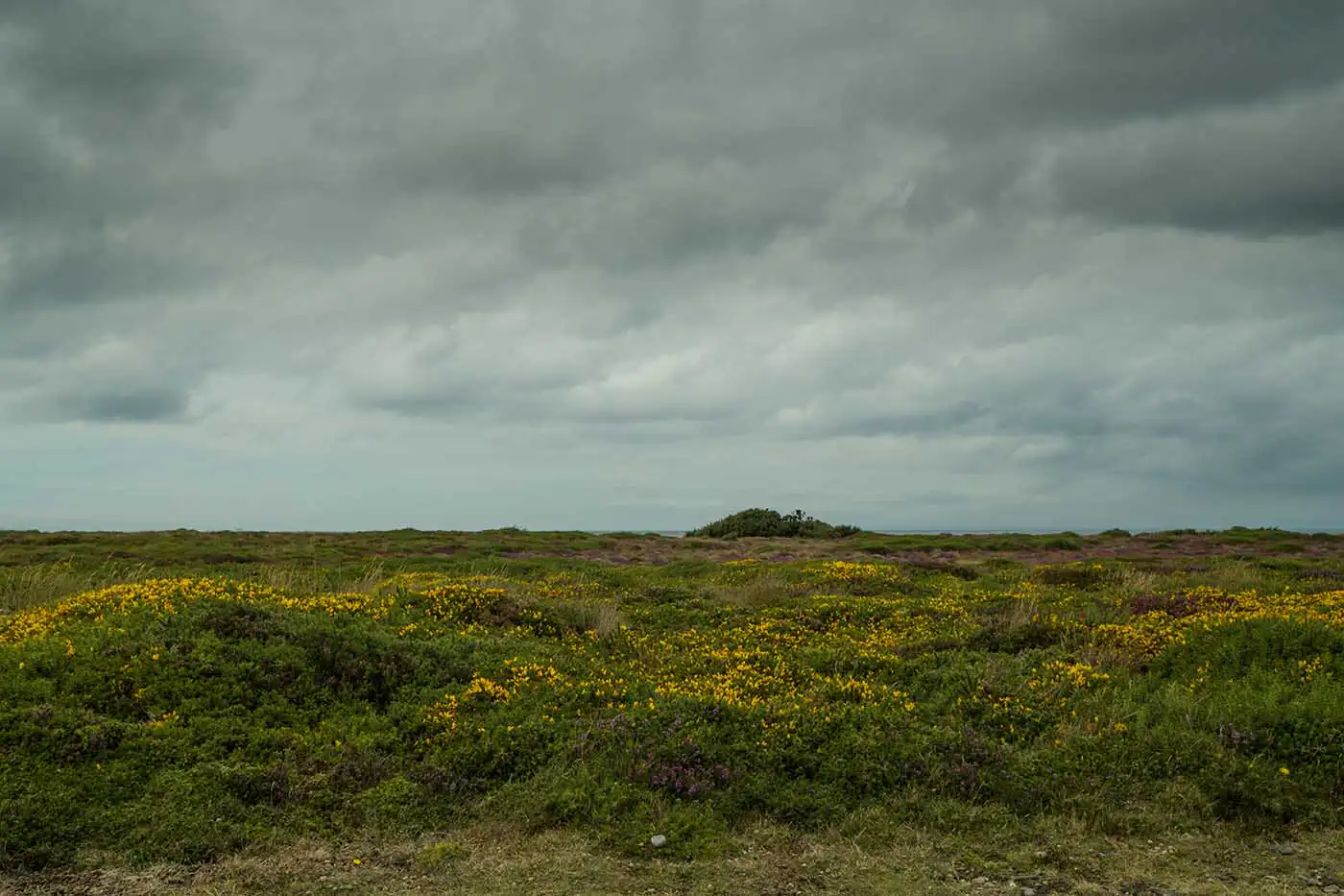
This theme continues and after a few more ups and downs you’ll arrive at the 437m (1,434ft) Cronk ny Arrey Laa where you will be met with some spectacular views as its western slope rises directly out of the sea. As you head downwards you’ll pass White Beach before arriving at one of the Island’s most stunning bays, Niarbyl, depending on the season look out for grey seals, dolphins, porpoises and even basking sharks.

This west-facing coastline has no light pollution from built-up areas and you can get some of the best sunsets on the island.
Niarbyl to Peel
Distance: 10 km / 6 miles
This section of the Raad ny Foillan begins at Niarbyl Cafe and Information Centre and as you head along the coast you will arrive at Glen Maye. Here you should make time to explore the ancient woodland with its gorge, waterfalls and pebble beach.

After Glen Maye, you will follow the clifftop path and get the first glimpse of Peel from Peel Hill and its monument, Corrin’s Tower. Your descent down into Peel will give you some stunning views over Peel and Peel Castle before finishing the walk at Fenella Beach.

Peel to Kirk Michael
Distance: 11 km / 7 miles
Leave Peel behind by following the promenade until you reach the red sandstones of Peel Headlands. As you ascend up the hill you’ll have great views back towards Peel and its surrounding areas.

Most of this section takes you along the route of the old Manx Northern Railway (MNR), which ceased operating in the late 1960s and the multiple viaducts were demolished a few years later. Eventually, you will reach the pillars of the viaduct at Glen Mooar which marks the routes switch to the beach. From here it is just a short walk to your finish point at Glen Wyllin campsite on the outskirts of Kirk Michael.
Kirk Michael to Jurby
Distance: 11 km / 7 miles
Starting your journey at the Glen Wyllin Campsite but you have a choice, you can head north along the old railway line to Glen Trunk and then join the beach or if the tide is out then start on the beach.

This stretch is all sand and shingle along the beach until you arrive at your finishing point, Jurby’s Sartfield Beach.
Whilst in Jurby if you are interested in transport history then visit the nearby Isle of Man Motor Museum and Jurby Transport Museum.
Jurby to The Point of Ayre
Distance: 13.5 km / 8.5 miles
Starting at Jurby (Sartfield) Beach you will continue along the shoreline towards the Point of Ayre. This is a continuous beach section and to add some variety, you can take one of the many heathland pathways that hug the coast.
As you near the Point of Ayre, the area is particularly rich in birdlife so special care should be taken not to cause disturbance during nesting season, often roped-off areas protect the nests. A visit to the seasonal Visitor Centre is a must for information on the area and its wildlife.

The lighthouse at the Point of Ayre is the northerly tip of the Isle of Man.
Point of Ayre to Ramsey
Distance: 9 km / 5.5 miles
This section is excellent for spotting many species of birds and the occasional seal. Start your walk at the Point of Ayre Lighthouse and follow the route along the sand and shingle all the way to your finishing point of Ramsey.
Ramsey to Maughold
Distance: 7 km / 4.5 miles
This walk takes you from the harbour town of Ramsey along to the coastal cliffs of Maughold.

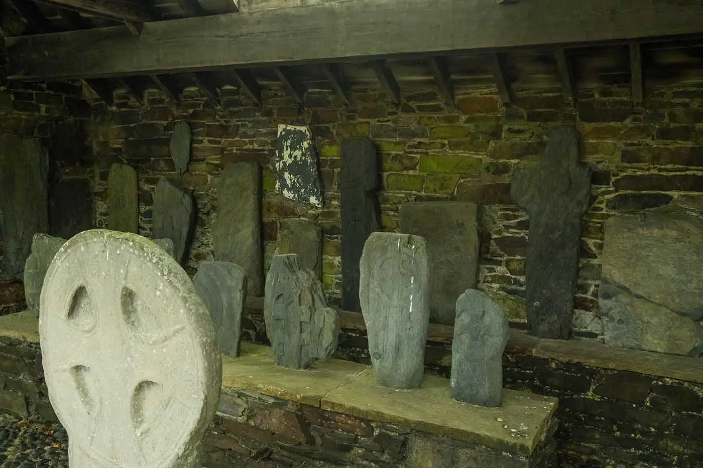
Leaving Ramsey you’ll head over the electric railway line to reach Port Lewaigue and then have a combination of coast path and road stretches until you reach the cliffs at Maughold Head. You have some great scenery in this section but a must is a visit to Maughold church which has a large collection of Celtic crosses from the early Christian period (6th-13th Century).
Maughold to Laxey
Distance: 14 km / 8.5 miles
On this stretch, you head inland and out of all the sections of the coast path you have less actual coast scenery. But you do have the wooded Dhoon Glen with its dramatic waterfall called Big Girl and the rock pools and pebbles at Dhoon Bay beach.
After Dhoon Glen the next stop is Laxey Village where you can take in views of the bay before a descent to the small fishing harbour and beach.

When in Laxey you have the mining history with the Laxey Wheel and the mountain of Snaefell at over 2,000ft. Snaefell is a possible diversion with options to walk or use the Mountain railway to take you part of the way or all the way to the top.
Laxey to Douglas
Distance: 15km / 9.5 miles
Begin your walk at Laxey beach and then follow the steep footpath leading towards Baldrine. Take time to discover the glen and secluded cove of Garwick Bay before continuing on to Ballanette Country Park, where you can explore the picturesque reserve with its abundance of wildlife and scenery.
As you continue, you will pass Lonan Church, known as the chapel by the shore with a 10th-century decorated cross in its original positioning. Keep following the path into Groudle Glen, where you can see the restored Victorian-era Groudle Glen narrow gauge railway that used to take visitors down to the coastal zoo which has long been closed.
Then just a short walk to and then along the promenade at Douglas and the end of the walk.
If you want to extend your walk or include some other options then you have:
- The Heritage Trail (16 km, 10 miles) follows the old Douglas to Peel railway line across island from east to west.
- The Millennium Way (45 km, 28 miles) uses an ancient ridgeway route, from near Ramsey it goes south over the island, via the slopes of Snaefell finishing at the medieval castle of Rushen.
- The Herring Road (16 km, 10 miles) walk takes an old fishermen’s route from the coast at Castletown north to Peel.
If you have walked the Raad ny Foillan Coast Path either in full or just a stage then let us know and send us your pics to our Facebook or Twitter pages. Look forward to hearing from you, seeing your pics and even getting your advice.